If you’ve ever got out of the car at Cape Point and watched helplessly as your hat sails over the viewing rail then you’ll be comforted to know that the place to which we send over a million visitors a year has – officially – the worst weather anywhere on South Africa’s coastline.
Cape of Good Hope? Cape of Storms, more like it.
This was the name given to the Cape Peninsula by the more realistic Portuguese. Cabo Tormentosa was their more apt name for it and with good reason. It blows at gale force for nearly a third of the year at Cape Point, the famous tip of the peninsula that is still home to the country’s most powerful lighthouse. Not that the lighthouse is all that effective: there are over 650 recorded shipwrecks off the peninsula alone and you can see several in the Cape of Good Hope Reserve – forlorn-looking tangles of rusty iron draped in cormorants and barnacles.
Realising the Cape of Storms needed to sound a bit more attractive to sailors, Portuguese King John II choose a more enthusiastic description: Cape of Good Hope and the air of positivity was buoyed by Walter Raleigh, noting its fair and stately beauty as he sailed past in 1580.
And on a fine sunny day it certainly is the fairest cape. The views take in two oceans – the Indian and Atlantic – as well as the meandering skylines of several mountain ranges. Flowers are out, animals are visible and busy, and the sea sparkles in happiness.
It’s wonderful, don’t get me wrong, but for me the Cape of Good Hope is best explored after a storm has churned everything up from the ocean and drenched the fynbos in rain. After all, with five percent of the world’s marine coastal species and a plant list longer than Canada’s, you’d expect the Cape of Storms to have a few surprises in store for the early morning beachcomber.
Perhaps too there is another side to my excitement at wandering the Cape’s wild, wave-thumped beaches: we’ve been doing it here since the Early Stone Age – that goes back to 600 000 years ago – finding our food at low tide and after a storm: washed-up seals, palatable green seaweeds, torn-off clumps of mussels – it’s all there at your feet. The Khoisan who lived in the Cape before anyone else knew the coastlines well (the Dutch settlers called them Strandlopers – beach walkers) and in the case of the Khoisan living on the Cape Peninsula, they barely ventured from the coast by all accounts. Even the other Khoisan thought they were a bit odd.
It may have been several hundred years since the Strandlopers foraged at on these beaches. You can drive there now of course but once you enter the Good Hope Reserve the landscape is virtually unchanged and the imagery is the same – it’s Cape Point after the storm.

The first things you notice after a Cape storm are the great tangled ropes of kelp washed up on the beaches.

The drift line is studded with stranded blue bottles – a bizarre colony of animals that live & work together – also called a Portuguese Man of War.

Not sand snakes but the underground hunting tunnels of Cape golden moles, on the snuffling hunt for worms in the nutrient-rich beach sand.

A cousin of the blue bottle, the By-the-wind Sailor uses its transparent sail to drift across the water while it catches planktonic prey with its tiny tentacles.

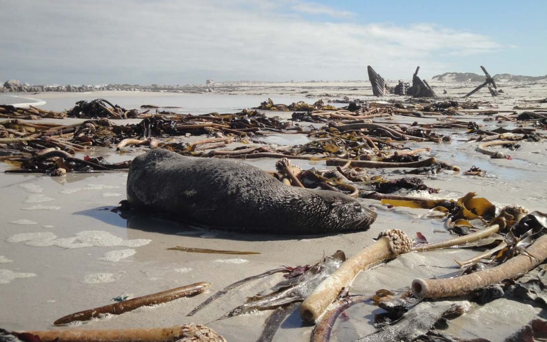
I guess that’s why they call it ‘The Shipwreck Trail’ – this is the Thomas T Tucker, wrecked in World
War Two while trying to evade German U-boats.

Scavengers are quick to arrive on the beach after a storm. Now they are kelp gulls & flocks of
sacred ibis like these but in the time of the Strandlopers it was lions & hyenas too.

Minced blobs of jellyfish coat the beach, an abundant food source of plough snails, a set of blind gastropods that locate their food via a sharp sense of smell.

Cold weather & rain have triggered a local beauty into flower: Serruria villosa – the Golden Spiderhead – a member of the Protea family & found only in the southern Cape Peninsula.

Also in full bloom were dainty white Ericas – heathers – smelling sweetly of honey & attracting the
attentions of a type of fly – a possible pollinator.

The piece de resistance – Gladoilus bonaespei – a crushingly rare iris found only in a few damp & wild spots on the Cape Peninsula; its fitting name in Afrikaans is Vlamme – Flames.

Indian Ocean? At Cape Agulhas?
Hi Diana – it’s actually the Atlantic Ocean, a little further down the coast from Olifantsbos Bay in the Good Hope Reserve. The name Olifantsbos is intriguing but I doubt there were elephants so far south on the peninsula and trying to make a living out of fynbos. Olifantsbos is probably a reference to the big rounded protea bushes – pincushions and mimetes species – that may have looked like elephants from a distance.